Showing posts with label Texas state parks. Show all posts

Tuesday, 29 January 2013

Caching Down to San Anton.....io

I've been working on two Geocaching challenges lately, one is the Texas County Challenge which is a long term goal and would be amazing to accomplish. To complete it you need to find a cache in all 254 counties which equates to several thousand miles of total driving I suspect. After this past weekend's trip I sit at 114 counties completed. The counties we visited this time were Val Verde, Edwards, Kinney, Real, Uvalde, Bandera, and Medina.


This is also the second year for the Texas State Parks Challenge which hides caches at most of the Texas State Parks and administrated areas. We visited Seminole Canyon and Garner State Parks, and Hill Country Preservation Area on this trip.


In Seminole we hiked the Rim Trail and the Windmill Trail which give great views of the canyon. Unfortunately our timetable did not allow us to stay for the ranger led tour of the pictographs but I would like to visit again for that experience. Seminole is not a large park in terms of the paved "tourist" area but with miles and miles of back country trails to the Rio Grande, it is worth the visit even in the remote location. It appeared to have very nice RV and tent pads.


I am told Garner State Park is best known for its access to the Frio River, and that in summer months it can be so busy that they actually close the gate to hold attendance to a certain number. Even on a cool winter day the river was very active with families fishing in the dam pools. We hiked up one of the cave trails and the terrain surprised me as it quickly becomes a matter of finding foot holds and climbing up steep limestone ledges. Which are also the reason for the great caves found in this area. They have a mountain (hill) named Baldy which looked like it would have one heck of a vista, we even saw tiny dots of hikers up there, but once again that is a hike for another day.


The last area was Hill Country Preservation Area. I was amazed at how large this area was and it is so tucked away that you really have to be looking for it to know it is there. But once you arrive, you find an area very much designed for both hikers and equestrians. The horse trails and ranch were very popular when we were there. Also even though we seemed fairly isolated when driving down the parks roads we arrived to a hiker parking lot with twenty cars in it! People were dressed in trail running outfits that looked as if they were in a city park for a short jog, but where could they be from? There are no large towns nearby so this secret seems to be out that Hill Country is a fantastic place for a day trip hike. There are also many back country camp sites and primitive sites for camping. One funny thing we noted in the area is that the locals seem to be trying to put a run on the local coyote population. We saw many fences decorated like the one below. A strange habit.


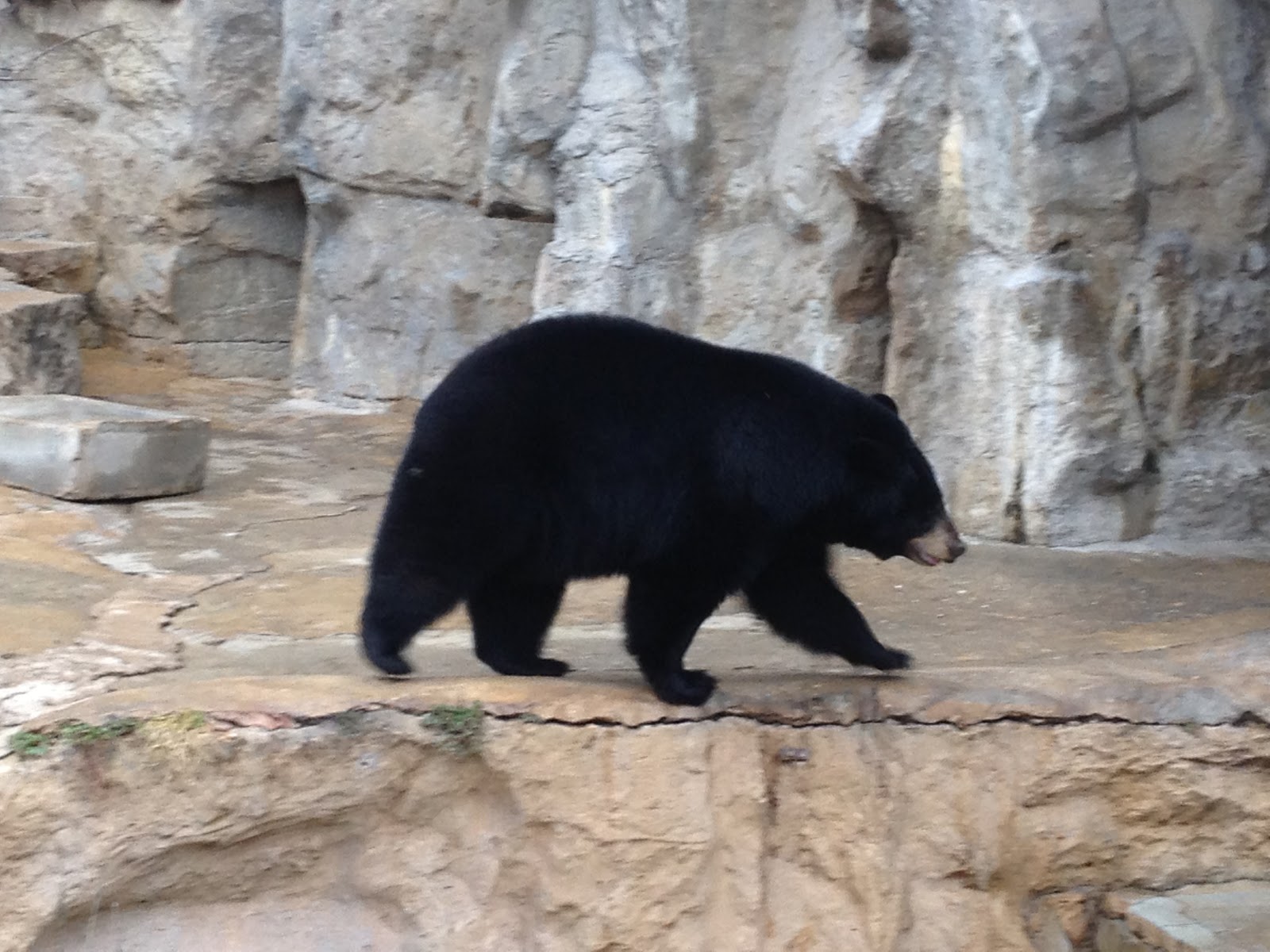
Sunday we took it a little more easy and visited the San Antonio Zoo. This was my first time and I was impressed by the presentation and condition of the facility, especially considering it will celebrated its 100th anniversary in March of 2014.


There is already construction under way for a large new area to celebrate the centennial but the rest of the park shows that they are constantly working to maintain and improve the living conditions of the animals and the way visitors interact with them. The animals seemed very happy in their enclosures and the staff was very helpful in interpreting the exhibits. I can't wait to visit again.
Saturday, 17 March 2012

10th Annual Texas Challenge - Ray Roberts State Park

N 33° 22.811 W 097° 01.973

From the event page: For 10 years, the Texas Challenge has become THE annual geocaching social event of the state of Texas. The contest itself has grown into a weekend of activities for both people wishing to participate in the challenge and those people who wish to only casually attend! Last year’s attendance was over 300 people! 

The 10th Annual Texas Challenge MEGA coin


The West Texas team began planning our trip to the Dallas Fort Worth area around the first of the year. Very few of us had ever attended a Texas Challenge before so we were going mainly on the rumors and chit-chat we had heard from past attendees and speculation as to what to expect. Being the smallest team registered with only about 30 Challengers we knew we had an uphill battle ahead of us. Also, as if that was not enough the weather forecast appeared to be going south as we approached the weekend. Regardless, we saddled up and made a wet drive over six hours to Denton, Texas just north of DFW. Along the way we found a few caches, ate some great burgers at Red Robin in Abilene and hoped for a break in the rain.


Friday night we arrived in Denton to moist ground and drizzling rain. We checked in at our hotel (thank goodness we didn't plan to camp) and drove to the park for a Friday night icebreaker and early registration. The park was already busy with cachers, there were swag bags, tee-shirts, vendors, and best of all.... FREE dutch oven cooked cobblers in all kinds of flavors. Definitely high on my list in the cold weather. The hosts were kind enough to cook burgers for us all and we socialized with old friends and made many new ones. As the evening ended, we drove back to our hotel still hoping for less rain and warmer temps.

Sunset over Lake Ray Roberts


The next morning we awoke early and had some breakfast in the hotel before driving out to the park. The rain was absent and the ground had dried somewhat which was very good. I had elected to get a breakfast ticket for that morning but in the end I was glad I had eaten at the hotel. Our team assembled under one of the many picnic pavilions and began to discuss strategy. At 9AM our leader Travis was given a USB stick with coordinates to 120 unpublished geocaches hidden throughout the park. They ranged in difficulty and terrain, from a container under a tree, to climbing a tree, to swimming out to an island )no one on our team was that brave). There were also Mystery Caches that involved doing tasks like darts, and disk golf. We were all given scorecards to track our finds and at 10AM sharp the flood gates opened and we spread out to divide and conquer. 

Tools of the Geocaching trade
Travis and I started in the northern section of the park. We quickly racked up four First to Finds (FTFs) before meeting all the other cachers that had the same idea as us. Luckily, one of those FTFs were scooped from another team that missed locating the cache. In each of these virgin containers we found FTF Pathtags which are very nice little metal coins minted just for this event. Our biggest mistake came next when we decided to stick to the trails and hoof it down to the southern unit of the park. Despite only being 1 mile as the crow flies, it ended up being over two miles on a horse trail with very sandy soil. Also, about the time we entered in the trail the rain started again. At first it was a very light mist, but soon enough there was a steady downfall leaking into all our clothes and gear. Undeterred, we continued, and climbed a tree or two with shoes quickly becoming blister-creating buckets of water. After 15 finds and a few misses we made our way out of the thick to the nearest First Aid point where we could turn in our scorecard. Unfortunately West Texas finished last this year when the scores were tabulated, but despite the rain and cold I think everyone had a good time... well as good a time as you could have in 44F weather with rain and mud and wind :P


Just a few of the braze souls who made it through the storm


Sunday morning we met back up at the park to eat some breakfast burritos and pick up litter all around the area we occupied for our event. Many bags of trash were collected and very little of it was created by geocachers I am proud to say. We always like to leave things better than we found them. After this CITO event we gathered up everything and made the long drive back to Midland. Since it was day light savings we lost an hour of sleep, but luckily the rain finally broke!


The slightly soggy remains of the West Texas Team - Post event


For a geocaching event to be considered a Mega Event over 500 geocachers must attend, these events take loads of organization and are few and far between. Almost 800 people had posted their intent to come to Ray Roberts State Park March 9-11, 2012. In the end terrible rainy weather reduced the total to just 575 fearless rain-loving crazy people.

Tuesday, 6 September 2011

Labor Day Weekend: Balmorhea State Park

We decided to take a short two-day vacation for Labor Day weekend and explore some new Texas State Parks we haven't been to yet. I've been puzzling over which parks to visit in warm weather and which to save for the fall and winter. Balmorhea was top of the list for a late summer visit because it is all about the pool! From Midland the drive takes about two and a half hours, once you turn south and the Davis Mountains begin to loom in front of you, you know you are close.

N 30° 56.279 W 103° 49.654
Just west of the park is an old church I likely would have never known about if not for geocaching.
The back wall preserves the original adobe and even mid-day on a Friday there were half a dozen or so prayer candles burning. From the cache page:
Written records for Mission Mary began in 1902, when a thirty four year old priest from the Netherlands started recording baptisms and marriages. Father Nicolas Brocardus arrived in the United States in 1892 and started serving the Big Bend in 1897. At first Father Brocardus rode the circuit on horseback or in a buggy, later in a Ford Model T. Father Brocardus made his rounds about once a month , at that time baptisms and marriages were performed.

Like all growing communities Calera residents eventually decided that they needed a church building, the structure was made of adobe and rock. Although the community was financially poor they banded together to construct the adobe structure( see Lupe Renteria's Story). This original building served the community until the late1930s or early 1940s when the diocese that was building a new church in Brogado plastered the original adobe building. Since Calera never grew into a large community it remained a mission first served by Father Brocardus from Saint Josephs Parish in Fort Davis. Later responsibility for Mission Mary fell on the priest from Brogado. Mission Mary was eventually abandoned and only the Church at Brogado remained.


N 30° 56.747 W 103° 47.009
After paying our $7 per person entry fees we drove over to the historic cienega and checked out the exhibit on the natrual wetlands that once covered a much larger area of the park before the CCC built the swimming pool in 1935. In creating the natural pool they destroyed the wetlands that the springs here fed, now they have been restored in part and are home to at least two endangered species. We found the official Texas State Parks cache for Balmorhea and spent some time looking through the viewing windows at the fish in the surprisingly clear water. It was getting hot so we left the wetlands for the pool!


One of the most unexpected encounters we had at Balmorhea was with the bats. In the cienega viewing area we first spotted a small dead bat on the ground. Once we made our way to the pool there were many more bats to be found although we never saw a single one. The building that houses the public restrooms and changing area is absolutely infested with bats! If you stand in the breezeway to the ladies room you'll here their high pitched squeaks in the rafters. There are also the tell-tale signs of guano and urine on the ground in the cracked beams and adobe. Then there is the smell. It isn't as overpowering as some caves I have been in but the ammonia smell is unmistakable. I am sure if you hung around here until dusk you would be rewarded with a good show as there seems to be a large colony.


The pool.... it is one of the coolest places I have ever been to swim. The surface is finished like two conjoined Siamese Olympic pools complete with ladders and diving boards. However, the big difference between this pool and any normal pool is that it is around thirty feet deep at its deepest, the bottom is all natural bedrock and spring fed, and lastly... THERE ARE FISH! Minnows, fish, large catfish, turtles even. There were swimmers of all ages, and towards the end of our stay three scuba divers even showed up. The whole facility is very clean and well maintained while keeping a rustic sort of feel to it.
San Solomon Springs, near Balmorhea, is an oasis in arid West Texas. It's the sixth largest spring system in Texas. The springs have provided water for travelers for thousands of years. Earlier the springs were called Mescalero Springs for the Mescalero Apache Indians who watered their horses along its banks. It is believed the Jumano Indians irrigated their corn and peach trees from the spring. The present name was given by the first settlers, Mexican farmers, who used the water for their crops and hand-dug the first irrigation canals. Today the springs are in Balmorhea State Park in Toyahvale, Texas, and the tremendous flow of the springs (22 to 28 million gallons a day) is used to feed a large swimming pool. It's the largest (two-acre) and nicest spring fed swimming pool in Texas after Austin's Barton Springs.

After getting pruned fingers, meeting new fishy friends, and doing some high dives (for Science!) we packed up for a thirty minute drive to Davis Mountains State Park where we had accidentally booked a room at the Indian Lodge thinking it was at Balmorhea State Park. In the end it was a happy accident as we had a great time there the next day. At a road side historical marker I struck out on the cache I was hunting but found this three and a half foot long rattlesnake skin!