
If you haven't read Part I of our trip,
start here. After leaving Rattlesnake Springs we made a side-trip out to Sitting Bull Falls which I had heard was a great little hike and a work of the CCC-era park building program. After an hour or so of driving we found two regrettable things, it was $5 a car to enter, and it closed in 30 minutes. We opted to leave it to another day. I regret this deeply now because the Last Chance Fire that started Saturday is said to have greatly impacted the area and it may never be the same as it was on last Friday when we were there. But we left, and returned to Carlsbad for the night where we ate a fantastic dinner at Danny's BBQ and stayed at the brand new Fairfield Inn.

Saturday we woke up around 6AM and made our way down National Parks Hwy to Guadalupe Mountains National Park. We first went to the Visitor Center and stamped our passport to mark our 60th official National Park visited and got some information from the Rangers about camping options. We went to the Pine Springs Campground and chose a site, fixed some water and lunch for the hike and began our trek at approximately 10AM. The trail to Guadalupe Peak is mostly gravel and crushed rock with many switchbacks that slowly gain elevation until you transition from from the alluvial slopes into the bedrock of the Guads which happens to be a limestone reef composed not of coral like modern reefs but sponges, algae mats, brachipods, crinoids, and other manner of critters with preserved carbonate skeletons. El Capitan is the best known and most prominent outcrop of this reef, but it creates a horseshoe shaped atoll that the Guadalupe Mountains are but a small portion of.

After a mile or so the trail loses a lot of its steepness and the flora transitions from the desert scrub brush into pinon pine in what is known as a "floating island forest." The shade and extra breeze was wonderful and with temperatures in the high 70s I can't imagine much better weather for the hike. Even though the grade of the trail wasn't as steep we really started to feel the hike at this point, and even the sight of the Guadalupe Peak Campground almost wasn't enough to spur us on. We took a lot of breaks along the way, sometimes we snacked on granola and such, but mostly we drank water and Gatorade. The NPS suggests one Gallon of water per person per day on this trail. I drank 5 liters+ and Steph drank 2 liters+ during the course of our journey there and back again. Rounding the corner of the meadow the campground resides in we finally saw our goal before us. It bolstered our spirits but also dampened them just a bit because it was still a long ways up. We crossed the "highest bridge in Texas" which actually made us walk downhill into a saddle.

We lamented that we were going the wrong way, but passed a couple of hikers coming down from the summit that gave us words of encouragement that spurred us on. Many of these hikers had passed us on the way up; I never claimed to be athletic. The last mile is almost as bad as the first mile, there are maybe half as many switchbacks and the grade isn't as steep, but the trail is loose limestone chunks that are hard on the ankles. We summited the peak at about 3PM, five hours after we began!

The trail is a little over 4 miles long, 8 miles round trip so we didn't set any land-speed records but that was never our goal either. The important thing is we did it and the views we received were indescribable. If you are going to truly visit Guadalupe Mountains NP this is the hike you must do. We signed the mountain register, ate a small lunch, then crashed on a ledge for a while. The return hike was uneventful, we met a Ranger that had found a camera on the trail and was looking for the owner and a chatty Irishman that talked to himself in another language. (Presumably Irish?) We returned to the trail head at 7PM, a 9 hour hike! There isn't much else to say, we washed up and cooked some quick dinner before hitting the air mattress.


 The previous evening we had been stargazing and seen some smoke coming over the Guads, today that smoke was much more ominous so I asked in the Visitor Center about it and was told it was called the Last Chance Fire and was likely started by hikers making a campfire. (Why are people so ignorant sometimes?) After a brief chat with the Rangers about a lost campground host that had been found Friday night before we arrived we departed Pine Springs. The McKittrick Canyon Visitor Center is an unusual one as there are no Rangers stationed here, and the displays are outdoors in a covered pavilion. We looked these over a bit, and from the pictures I've decided we will likely return in the fall to see the trees change. I wanted to get the McKittrick Canyon Nature Loop Earthcache but there were signs the trail was a bit steep in places and both of our legs were Jell-O from our hike to Guadalupe Peak the previous day. So I made a quick backwards loop on the trail to gather the needed information while Steph filled water bottles and packed some snacks. Then we hit the trail to Pratt Cabin.
 The cabin was built by Pratt as a getaway in his own private oasis in the desert. He had all the supplies brought in by horse and mule to prevent needing to harvest the trees and stone in the canyon and wreck the natural beauty. It is extra-unusual as the whole cabin is made of stone including the roof!
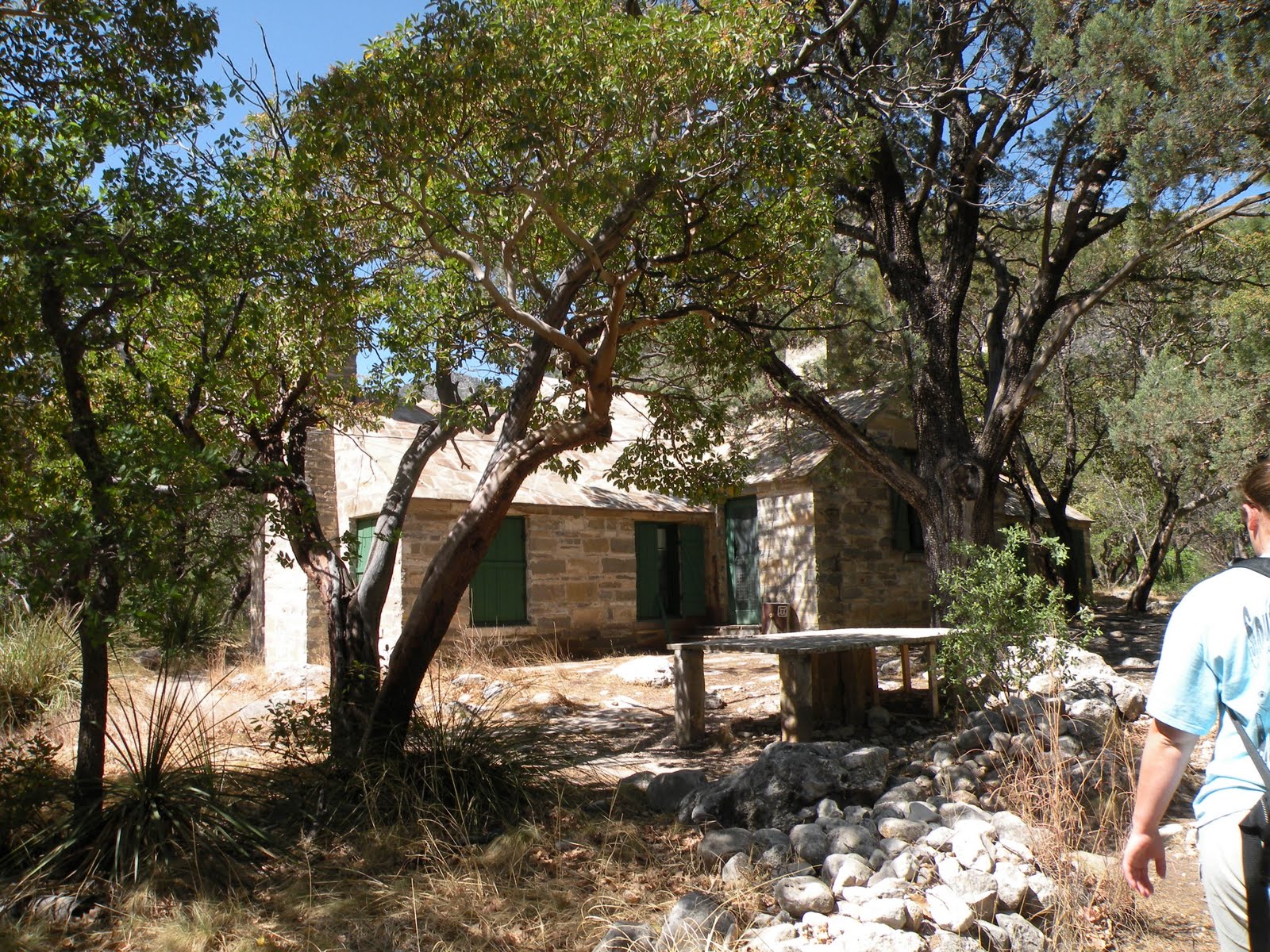 The trail there is about 2 miles (4 round trip) and is mostly flat so we made the trip in just a couple hours although it was still pretty painful to be honest. But to sit on the back porch of the cabin and feel the breeze blowing through the trees is an experience that is hard to duplicate. We made it back to the car just as the wind really started to kick up and then began the drive back to Midland. Overall, it was one of the best getaway weekends we've had in a long time, maybe since we left Colorado and I look forward to a return trip. (Probably in the Fall).


